
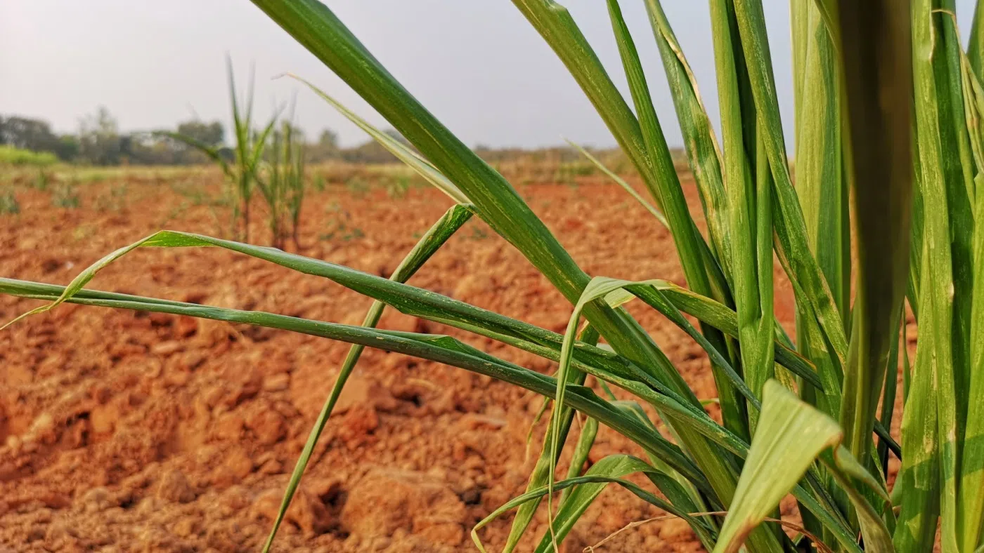
The Assistant State Climatologist for North Carolina Corey Davis joining me now. And Corey, I understand that you’re getting some reports from farmers in the field that they’re starting to see some corn rolling. Now, for those who don’t understand what that means, that does not mean that corn cobs are falling off and they’re rolling through the fields. Farmers certainly know what that means. But could you explain what that is and why is it happening?
“Well, that’s right, Mike, it’s not what you said. It’s not the corn just rolling away, but it is a really interesting phenomenon that we sometimes start seeing around this time of the year. As you know, Mike, we get reports every week from ag extension agent across the state into the North Carolina Drought Council. And the operative word this week was rolling. We heard about corn leaves rolling as far west as Union County near the Charlotte area. You heard about it as far east as Craven County, right along the coast. And what’s happening is that, especially during the afternoon hours, don’t see those green leaves on the corn crops just roll up. Kind of those edges are curling in a little bit. And obviously this could be pretty bad looking. It could be concerning when you see that, because it looks like that, that crop is undergoing a lot of drought stress. Now that can be true if the soil moisture levels are a little bit lower and if the roots are not able to take up as much moisture and send it through the plant. But this can also just be a pretty normal thing for corn to do this time of the year, especially when it does start getting a little bit hotter, like it’s been over the last couple weeks. So what’s happening there is really self defense on the part of the corn. It’s curling those leaves in to reduce the surface area that goes to the sunlight. And at the same time as those leaves curl, it’s kind of like crimping a drinking straw. It’s trapping some of the moisture in the leaf tubes, in the stems, and keeping that moisture in some higher humidity air around closer to the leaves. So if you see the leaves rolling again, it can be a sign that the corn is a little bit stressful. It can also just be a sign that the corn is preserving water.”
What about at night? Do they unroll at night? What happens then?
“Yeah, usually things will go once the sun goes down, once it gets a little bit cooler, things will go back to normal. The leaves will unfurl and look like normal if you don’t see that unfurling happening and the corn stays rolled up at night. Can be a sign that you’re lacking in soil moisture, and there’s just not enough moisture to go throughout the plant. But also, this is a time of year where we start to see how well established the root systems are for the corn crops. If the corn had a little bit shallower root system. That might mean it went in the ground at a time where there was a lot of moisture, but as we started some of these hotter and drier days that topsoil moisture dissipates a little bit. The good news this year is that most of the corn in the Carolinas went in during the month of April. That was a pretty dry month, so that meant that the corn had to search a little bit deeper. Those roots had to go deeper to find the moisture. So again, I think even though it can look kind of stressful day to see the corn leaves rolled up like that, overall, the crops are generally in pretty good shape.”
You mentioned this time of year, well, this time of year is now a climatological summer, even though we don’t see that on the astronomical side yet. That’ll come later on this month. But for climatologists, what does that mean?
“Yeah, though the last two weeks have been really classic summertime climate conditions across the Carolinas, like we talked about, one of those signs is just those hot temperatures in the afternoons. Most days, we’ve been up in the upper 80s to low 90s, around normal for this time of the year. But the other real sign of summer is our precipitation pattern. We’re seeing more of those scattered pop up showers and thunderstorms. We had a great example of that earlier this week, back on Tuesday night, just one small storm cell tracked right over the Raleigh Durham airport dropped almost two inches of rain in a single hour. But if you look at from the reports from around there, Durham had almost nothing. Chapel Hill had almost nothing. Downtown Raleigh had almost no rain from that event. So all it takes is one small, strong cell over your area to make for a really soaking rain event.”
Do we see more of that kind of activity coming in the forecast? What does that look like for the next several days?
“We did have some more showers and thunderstorms moved through last night as a cold front pushed through that sent us for slightly cooler temperatures over the next couple days, but we’ll still be in the mid to upper 80s. We will be a little bit drier through the weekend, though, and that includes lower humidity as well. So that’ll be a nice, refreshing change from some of those hot and humid early summer days we’ve seen so far, then the next best chance of rain looks like it’ll happen on Sunday night. It’s another cold front that’s pushing through, maybe a little bit stronger, so maybe bringing a better chance of rain, and it’ll also cool us down a little bit more. By Monday, it looks like we’ll be in the low to mid 80s early next week. So again, keeping a pretty typical summer pattern, we certainly won’t complain about the lower humidity. But also, I’m sure the farmers, and especially the corn crops will be eagerly with that next round of rain late Sunday night.”
Yes, they will, and I’ll be awaiting those lower humidity levels as well. Thanks so much. Corey Davis from the state climate office of North Carolina, thanks, as always, we appreciate it. We’ll talk to you again next week.
“All right, thanks, Mike.”