
We’re about a week away from the official end of summer, and we’re already starting to see the fall temperatures come across the Carolinas. I’ve got state assistant climatologist Corey Davis here.
Corey, I’ve noticed a lot of dry conditions here lately. We just had a little bit of rain here in the Raleigh area for, like, the first time in about 10 days. What’s going on with the weather patterns, and are we seeing any drier conditions that are going into drought territory?
“Yeah, Kyle, I think you’re not alone. I think lots of folks are probably noticing some signs of dryness. We mentioned last week some areas were creeping up on three weeks in a row without any measurable rainfall, and some of those streaks — especially in northeastern North Carolina — have extended over the past week. They’re now almost a month into this dry spell. Now, for the most part, we’re looking at things like lawns turning a little bit brown in people’s backyards. Maybe some of those garden plants are wilting or needing some more water a little bit more frequently. We did pick up a little bit of rain last weekend, and I’ll say I was a little bit surprised in the timing of this. I mentioned last week that we really didn’t expect that rain until later on Saturday evening, maybe even overnight into Sunday. But some of those showers — and even thunderstorms — moved through a little bit earlier in the day on Saturday. That may have caught a few people off guard, but also it was nice to see some rain since it had been so long since we’d had any. But you’re right, it is generally trending drier, even closer to drought across the Carolinas. This week, we’ve seen an expansion of abnormally dry conditions on the Drought Monitor map. Now, almost half of North Carolina is abnormally dry, and a little over one-third of South Carolina — mainly down in the Lowcountry — is abnormally dry this week. Again, that just reflects some of those short-term rainfall deficits, missing out on that rain, especially over the past month. It’s mainly eastern North Carolina that we’re concerned about right now, and also some areas along the Virginia border. As you head a little bit further west, that’s where we got some heavier rain last weekend — especially almost three inches in the Triad, about two inches down in the Charlotte area, and two to three inches in parts of the southern mountains. So, it was good news for those spots, but for the places that continue to miss out, again, they are heading closer to that drought direction.”
Well, a little follow-up on that. So, you’re talking about, like, some areas that are abnormally dry. What’s the difference between abnormally dry and getting into drought territory?
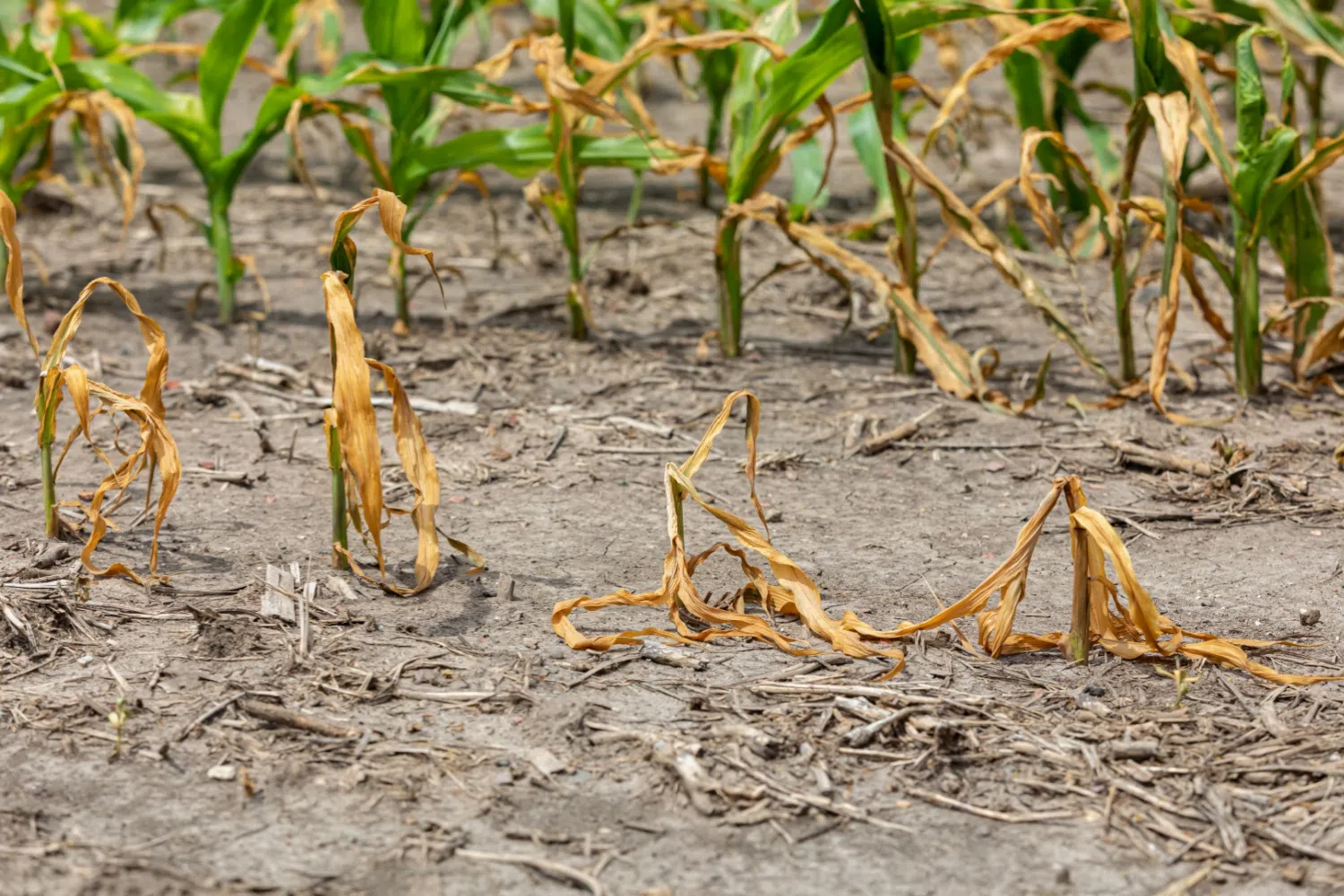
“Yeah, so this “abnormally dry” classification really just tells us that things are drying out, but we’re not setting up entrenched dryness that tends to lead to drought impacts. I will say, though, some of the reports we’re getting from agriculture this week definitely make it look like some areas are borderline drought — maybe even seeing some localized drought impacts. Down in Johnston County in eastern North Carolina, we’re hearing the soybeans are really struggling there. You know, we talked about how far along the corn has been. A lot of that corn is already mature and being picked out of the ground now. But the same is not true for soybeans. They are still in their development process, still need a little bit more rainfall. And there in Johnston County, we’re hearing that the leaves are wilting, even some of the growth is stunted among the soybeans, and there’s just no soil moisture right now for those crops to pull from. Other parts of eastern North Carolina are talking about the same thing with crops like cotton — even some of the late-planted corn is struggling up in the northeastern part of the state. So, we talk about this dryness versus drought. Those are the sorts of impacts that we look for. And again, when it starts to affect crop yield — which it certainly sounds like it’s close to that point in Johnston County — that’s when we think we are getting to that drought level.”
Hopefully we get some rain here shortly to try to prevent that from happening. The peak of the hurricane season just passed — it’s typically around Sept. 9 or Sept. 10 — and we really didn’t have any named storms in the tropics around this time. So, what’s the forecast looking like over the next week, looking into the tropics and possibly affecting the Carolinas?
“Yeah, this was a really unusual occurrence — no activity at all, not even a system being monitored for development — as we passed the peak of the season earlier this week. That is pretty rare, to cross through this time of year when we’re used to seeing so much activity and just not having anything. Now, the Atlantic is starting to heat up maybe a little bit. The Hurricane Center is watching a system that’s moving off the coast of Africa. For now, they’re only giving about a 30% chance of development over the next week, and it is still a very long way out for potentially affecting us. You know, last week we talked about another storm that was in a similar position. It was looking more favorable for development, but it ran into some pretty unfavorable conditions — especially lots of upper-level wind shear — and just ripped that storm apart. So, instead of having that storm to watch over this next week, it’s just gone at this point. And now we do expect, as we head later — especially into September and even into October and November — that there should still be some activity out there. One stat I saw this week that I thought was interesting: The last time we had this little activity through the middle of September was back in 2022. And if you remember what happened later that fall, we had Hurricane Ian that came up from Florida, and then off our coast in late September. And then Tropical Storm Nicole came through western North and South Carolina early that November. So, both of those are very good reminders that even past the peak of the season, we are not out of the woods for tropical activity. There are still at least two months left where we can — and will — see some more storms form.”
I agree with you. You know, you normally see a lot of activity in this area, so now it’s being quiet — it just almost sounds like it’s an omen for potential named activity in October and November.
“Yeah. And you look back at where we were at this point last year — we were still about a week away from seeing that unnamed potential tropical cyclone form along the coastline. And we were still about three weeks away from Helene forming down in the Gulf. And of course, we remember what that did across western North and South Carolina. So again, still plenty of potential for activity. The Atlantic is still very warm as well. So, if some of those atmospheric conditions shape up and become a little more favorable, I think we absolutely will see some more storms — maybe even some coming our way over the next few months.”
All right. Well, let’s take a look at the weekend coming up. How are the conditions going to be for a lot of people still enjoying college and pro football around the Carolinas?
“It’s another one of those great fall-like weekends. Some really seasonable temperatures are expected. Both this afternoon and tomorrow, we’ll be in the low 80s in most areas. By Sunday and Monday, we could creep back toward the mid- to upper 80s — maybe a degree or two above normal for the year. But that is pretty much the story of the forecast, because it will be sunny and it will be dry. No rain is expected over the next seven days. There is a slight chance right along the coastline that they may see some showers going into early next week — let’s say by Tuesday — from a system that may form there. But again, most of the Carolinas will be looking at dry conditions. So, for those spots that are needing just a little bit more rainfall, unfortunately, they’re not going to get it into next week. But we’ll certainly have that fall-like weather to enjoy — even some of those nighttime lows dipping down into the upper 50s. Again, that’s something we started seeing a few weeks ago, and that is definitely a sign of September, when we start getting those crisp nights.”