
Well, we had our first major winter event of the year, and it looks like we’re going for round two this weekend. But how did all of that weather and all of that precipitation affect the drought totals here in the Carolinas? We got state assistant climatologist Corey Davis. Now Corey, let’s talk about last week. So that we didn’t talk about it because we’re heading into the weekend, what did the totals look like, and how did it shift to more of a minor event?
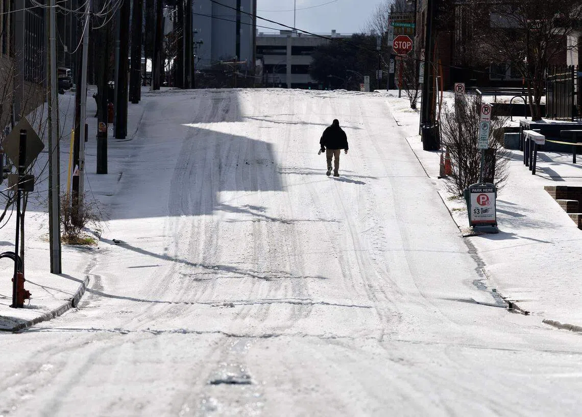
“Yeah, I think one thing is clear, Kyle, and that’s that we avoided the worst-case scenario. At this time last week, we were talking about a significant ice storm, likely across the Carolinas. We were looking at the potential for some ice accumulations of at least a quarter inch, if not half an inch or more, across a good chunk of central North and South Carolina. In the end, we did not see those levels of ice, at least on a widespread basis.
“The event started as some snow and sleet further north and west. So some of our northwestern counties in North Carolina, including parts of the Triad, ended up with two to three inches of that snow-sleet mix, and then, luckily, that sleet held on overnight through Saturday into Sunday morning. So even though we didn’t see widespread heavy sleet accumulations, we also didn’t see the freezing rain that we were expecting — really only a tenth of an inch or so of ice.
“In most areas, we did see some pockets of higher accumulations, especially down across the southern mountains, also up in the northeastern corner of North Carolina. A few spots there had about half an inch of ice, and they did see some localized power outages. But again, it was nowhere near as widespread or as severe as what we were expecting last week.
“As to why that happens, there’s really just one simple way to describe it. It’s thanks to the mountains. We had that cold air that funneled in from the north. The mountains helped anchor that cold air in place right at the surface, and that air was so cold at one point — it was seven degrees only a couple thousand feet off the ground — that any falling precipitation stayed in that ice form instead of melting into raindrops and reaching the ground as freezing rain.
“So again, very glad that we did stay mostly sleet, especially overnight last Saturday, and obviously not the big impact that we were expecting this past weekend.”
So in terms of, like I said, it wasn’t as big of an impact as we thought it was going to be. We avoided a lot of the major damage that states like Tennessee and Kentucky had. But let’s look at the Drought Monitor. How did this precipitation affect the Drought Monitor and the liquid totals that we received?
“And, you know, last week going into this storm, we were saying one of the only silver linings might be that at least it looked like a lot of moisture would be coming in, and that those liquid precipitation totals might help make a dent in the drought situation. With it being a more minor event, those liquid totals were also pretty low.
“We only saw half an inch to an inch of liquid across most of the Carolinas, and that actually made for a drier-than-normal week in most areas. So we’re still seeing fairly widespread severe drought conditions on the latest Drought Monitor map. We actually even had some degradation in far western North Carolina along the Tennessee border.
“These were areas that were kind of in between that big ice event out over Nashville and then that minor event here across the rest of the Carolinas. One thing to note is that right now, when you see that severe drought, it’s mostly being driven by the seasonal precipitation deficits that date back to the fall, as well as some of the surface water conditions.
“We look at our streamflow’s, especially across eastern North Carolina, and we just have not seen the recharge that we usually expect at this time of the year. It is unusual to have that amount of severe drought on the map. But again, it has been such a dry winter and a dry fall before that. That’s why we’re in this drought situation.”
Well, if you’re listening to this and you’re thinking to yourself, OK, we were talking about this winter weather, now we’re talking about it again. Yes, it is a little bit Deja vu, but not exactly the way it happened last week. So let’s talk about this weekend storm. What is going to be causing the storm, and what should we be expecting in the form of precipitation?
“Yeah, I know some folks were disappointed that we really didn’t see much of any snow last weekend. Of course, we’re getting later in the season now, so the clock is ticking on those snow chances. But it looks like the storm this weekend will definitely deliver really all across the Carolinas.
“We have a good chance of seeing snow, and that is the first big difference between this weekend and last weekend. Last week, it was one of those classic Carolina systems that would transition from snow to sleet to freezing rain in some areas, back to just regular rain by the end of the event. We don’t have that problem this time around.
“We are very confident that it will be all snow falling throughout the event, except for maybe some of those immediate coastal areas like the Outer Banks. We have such a cold air mass in place, really all through the lower atmosphere, that anything falling will stay in that frozen, snowy form. So that takes one of the variables out of this storm.
“The setup is a little bit different as well. We’re still looking at a low-pressure system forming down across the southeastern part of the country. Last weekend, that low really tracked right across the Carolinas. This weekend, that low pressure will stay more offshore.
“That will keep more of the cold air in place, keep less of that warm air from moving in, but it’ll still deposit a pretty good amount of moisture across the Carolinas. It’s a little bit tough to nail down the exact snowfall totals at this point. There are a few reasons for that, but I think it’s pretty safe to say in North Carolina, especially in the Piedmont and Coastal Plain, we’re looking at decent chances of at least four to eight inches of snow. Some areas could see up to a foot.
“And then in South Carolina, I think they’ve got a good chance of seeing two to four inches in those spots. And we mentioned some of those uncertainties. Anytime we see a setup like this, inevitably it seems like there’s a dry slot that forms somewhere across the state. That means some areas probably won’t see totals quite as high. But by the same token, usually we will see a band of heavier snow that forms somewhere across the state. So I think those totals, upwards of a foot, will definitely pan out for parts of the Carolinas over the weekend.”
How is this going to affect the drought map? One thing I’ve seen on TV station weather forecasts is how much snow and ice would equate to liquid precipitation. So use an example of a foot of snow. How much liquid precipitation would that be, and what effect would that have on a Drought Monitor that’s in severe drought?
“Yeah, typically across the Carolinas, we look at about a 10-to-1 ratio. So for every one inch of liquid, you can see about 10 inches of snow. Now, during this event, it is going to be so cold that we may see those ratios increase. It may be more like 15- or 17-to-1.
“So even though those snow totals may end up being pretty impressive, that doesn’t mean there will be a lot of liquid with it. Even if you see a foot of snow at the coast, that might only be about an inch of liquid, which, again, is pretty much average for this time of the year.
“Now, with that said, I do think that we will see some improvements, especially farther east, where we’re expecting those higher totals after this weekend storm. If for no other reason than that snow sitting on the ground, taking a little bit longer to melt and soak in, should finally give that recharge that we missed last weekend, that we really haven’t seen over the course of the winter so far.
“So those dry soils, the low stream levels, even some of our lower river and reservoir levels, they should finally get a boost after a nice, slow snowmelt here over the next week.”
But what’s the forecast looking like for the weekend and into next week?
“Well, it goes without saying that we will definitely be cold at least over the next two to three days as that snow begins falling late tonight and then continues on during the day. On Saturday, we’re looking at high temperatures mostly in the mid-20s, similar to what we had last weekend — very cold air right at the surface.
“After that, Saturday night and Sunday, when the snow tapers off, we should see those lows dipping down into the teens. Sunday night will be another cold one, probably upper single digits to low teens across most of North Carolina. And then finally, by Monday, we will start to see a rebound in our temperatures.
“Kyle, it’ll feel like a heat wave with as cold as it’s been, because by Tuesday or Wednesday of next week, we may actually be back into the 40s. Hard to believe, but again, we have seen so much cold air over the last couple of weeks that it will be a relief just to have a 40-degree afternoon.”
Oh, a heat wave when it’s 40 degrees. Gotta love it. That’s right.
“And also worth saying, as we switch into the month of February, we thought February had a pretty good chance of being warmer than normal. At least it looks like through the first half of the month, somewhat cooler air will stick around. So for folks that have gotten used to February feeling more like spring, it may at some point next month — but at least not right away. It looks like we’re going to have some of this colder weather at least for the next few weeks.”