
We were expected to see several inches of rain come through the Carolinas this past weekend, but according to all accounts, not a lot of areas saw that rain total. And now we have the first named hurricane of the 2026 Atlantic season. How is all of that going to impact the Carolinas and the drought map? We’ve got State Assistant Climatologist Corey Davis here. Corey, we did see rain come through the Carolinas last weekend, but we did not see a lot of the heavy rain that we were expecting. Tell us a little more about that.
“If we rewind to last week at this time, we were pretty hopeful of seeing a fairly widespread heavy rain event. A lot of the forecasts were showing those totals of 2 inches or more, especially across central and eastern North and South Carolina. In the end, most of the moisture stayed to our south. They saw some pretty heavy rain in parts of Georgia and Florida, but not a lot of that heavy rain made it up into the Carolinas.
“With that said, we did see some higher totals. The Charleston area, down along the South Carolina coast, saw about 2 inches. We also saw parts of eastern North Carolina pick up 2 to 3 inches, but those were really the exception and not the rule. Most areas, including across the Piedmont, saw less than half an inch from that event last weekend. And then, as we got a little bit further to the north and west, including up in the Triad area, those areas saw basically nothing in terms of measurable rainfall.
“So, as a result, we have seen some small improvements on the U.S. Drought Monitor map this week. The biggest changes in those eastern areas, some of those pockets of extreme drought in places like Horry County, South Carolina, and Brunswick County, North Carolina, they have finally improved back to severe drought level.
“Now, that level of severe drought still means they are dealing with longer-term rainfall deficits. They are still dealing with some low river and stream levels, and especially as we look at some of the deeper soil moisture levels, we are still seeing those run very dry over the last few months.
“But with the rain they did see, that should help the farmers who are trying to get out and start their winter planting. We heard last week from Extension in Robeson County, North Carolina, that things had been a little bit too dry to get some of those small grains in the ground. Well, that area picked up about an inch of rain this past weekend, so that’s good news for the farmers. Again, just getting that little bit of rain they needed to help get that growing progression going.”
There is the possibility that the Carolinas could see some rain this weekend, and that is due to the first named storm of the 2026 hurricane season to become a hurricane, all the way in October. Hurricane Isaias, formed off the coast of Mexico, is starting to make its way through the Gulf toward the Gulf Coast. Tell us a little bit more about this hurricane. How did it come together, and what kind of impact are we going to see in the Gulf?
“Yeah, they call it hurricane season for a reason, and that’s because we usually expect to see these stronger storms that reach hurricane strength. Like you said, it’s taken until the first week of October to get the first hurricane of the season in the Atlantic, and I’ll say I’m surprised it’s taken this long.
“We knew that this El Niño pattern would have these effects of holding down activity, especially down in the Caribbean. But when we look at the Gulf, the sea surface temperatures in that region have been at record-warm levels over the last few months. We knew that was a part of the basin that was just primed to see some storms forming.
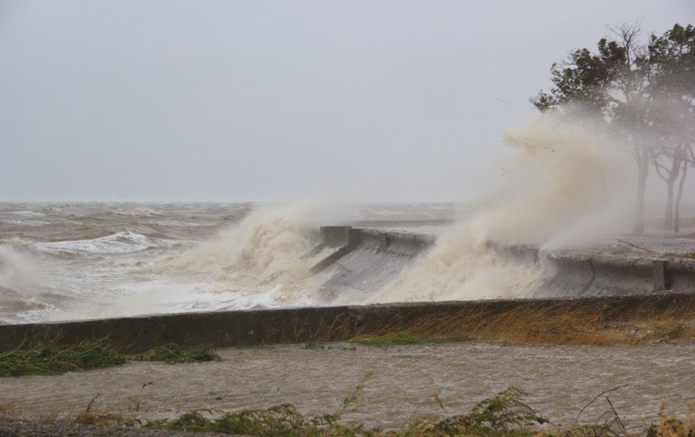
“We saw some shorter-lived, weaker tropical storms back earlier in the summer, but now this is the first real, bona fide hurricane, strong system of the year. And it has been rapidly strengthening over these last 24 to 48 hours. It reached hurricane strength back on Wednesday. Not sure if it’ll make it up to that major hurricane level as it makes landfall later tonight and early tomorrow morning, but down along the Gulf Coast, especially coastal Alabama, getting into parts of far western Florida, they could still be dealing with a pretty big impact on their hands from Hurricane Isaias as it comes ashore.
“Now, what we’re watching more closely in the Carolinas is how much rain we will get from the system later this weekend. This is kind of a complicated setup because the bulk of the moisture from Isaias will go off to our west. It looks like the remnant center of that storm will track across western Tennessee. But we’re also expecting another area of low pressure to form off the Carolina coast by Sunday morning.
“Some of that remnant moisture from Isaias will push off to the east, feed that low-pressure system, and that should help fuel some heavier rainfall in parts of eastern North and South Carolina. The big challenge, though, is figuring out exactly where that rain falls, who gets the higher totals, and who misses out.
“Because, Kyle, this reminds me a little bit of that winter storm that we had back in January of this year. We had two areas of low pressure on either side of us. We knew with that type of setup; some parts of the Carolinas would see lower totals. They would get less, in that case, snow.
“By the same token, we’re expecting parts of the Carolinas to see lower rainfall totals this weekend, especially during the day on Sunday. It remains to be seen exactly where that drier area will be. Some of the forecasts have showed a little bit further east, like in the Rocky Mount area. Some have shifted it further west, like toward the Triad area, and there’s always the chance that the Raleigh area could miss out as well. That’s kind of halfway in between each of those extremes.
“So really, we’re looking at most of the moisture, most of that rain moving in during the day on Sunday. The areas that do get some higher totals will be very well soaked by this event. We’re talking about the potential for 3 to 4 inches in spots. I also think we’ll see some of those higher totals out in the mountains, but again, in between, we may see some lower amounts. And just like with what this system last weekend, some areas may even struggle to see an inch in total.”
Looking at a lot of the models of the path of this hurricane, a lot of them have it making landfall near Mobile, Alabama. Is there a possibility that somehow the storm might shift a little bit to that landfall being east of Mobile that could impact the Carolinas even more?
“We have seen some small shifts over the last couple of days, but those have been more westward shifts than anything. And this is where I’ll give credit to some of the AI-based forecast computer models, especially some of Google’s computer models. These have been the most accurate, at least with this storm, showing that more westward landfall location.
“We’ll see how that verifies later tonight and early tomorrow morning when the storm actually does make landfall. But again, I think this is a sign that technology is improving some of these forecasts even more. We know always with hurricanes; it’s the intensity that’s a little bit tougher to get right. So, we’ll also see exactly how strong Isaias is when that eye comes ashore later today.”
All right, let’s take a look at the forecast. I know a lot of people are planning for fair season here in Raleigh next week. So, how’s the forecast going to look this weekend heading into the start of the State Fair?
“Yeah, for starters, let’s talk about that Friday football night tonight. We should not see any rain moving in yet tonight. Even down in South Carolina, it looks like most of that moisture will wait until tomorrow to move through. So, we are looking at mostly cloudy skies tonight, but very low rain chances. Temperatures probably somewhere in the upper 60s to low 70s.
“Once those high school football games kick off this evening, during the day tomorrow, that’s when we’re expecting that rain to start moving in across South Carolina, maybe parts of southeastern North Carolina as well. But the better rain chances look like they will come on Sunday.
“Again, we don’t expect widespread heavy rain across the Carolinas, but places that do get those higher rainfall totals can expect to see some pretty much wall-to-wall rain during the day on Sunday.
“After that, going into the first part of next week, we should clear up pretty quickly by Monday. Looks like high temperatures may make it up to around 80 degrees on Monday afternoon. And then we’re looking at high pressure building into the north by the middle of the week. That should bring some cooler temperatures, probably down in the low to mid-70s by Wednesday.
“And like you said, the first day of the North Carolina State Fair is Thursday of next week. I like at least that opening of the fair to be very seasonable as well. Temperatures probably low to mid-70s, maybe warming up a little bit going into next weekend, but looking at no expected rainfall chances either through those first few days of the fair.
“So, I know anybody who heads out then will probably be happy with the temperatures, happy with the clearer skies and some sunny weather as well.”